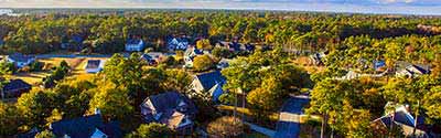
The Michigan Neighborhood Explorer helps you to research any Michigan neighborhood (census block group) and get home values, average household income, owner/renter/ occupancy rates, projected growth rates, boundary maps, comparisons to other communities, and much more.
Michigan State Flower - Apple Blossom
The area of Michigan was part of the original territory of the United States, being part of lands ceded by four states to the United States and designated in 1787 as the "Territory northwest of the River Ohio." Michigan Territory was organized on June 30, 1805, from the northeastern part of Indiana Territory, and included all of the Lower Peninsula, the eastern part of the Upper Peninsula, a small strip of northern Indiana, and a portion of northwestern Ohio that was later contested. In 1818, when Illinois was admitted as a state, all of the remainder of Illinois Territory was added to Michigan Territory, including almost all of present-day Wisconsin, part of Minnesota, and the western part of the Upper Peninsula; at the same time, the central portion of the Upper Peninsula and eastern Wisconsin were added from the former Indiana Territory. In 1834, Michigan Territory was enlarged from part of Missouri Territory, including all of present-day Iowa, the remainder of Minnesota, and the eastern part of North Dakota and South Dakota. Michigan was reduced with the organization of Wisconsin Territory and the cession of the Toledo Strip to Ohio in 1836. As a compromise for the cession of territory to Ohio, Michigan Territory retained all of the Upper Peninsula when Wisconsin Territory was organized, resulting in a boundary generally the same as the present state.
Although not yet legally established as a separate territory, census data for Michigan are available beginning with the 1800 census. The 1800 census includes the population of a small area that is in present-day Ohio and excludes the population that was enumerated with Indiana of a small area of present-day Michigan. The 1800 population of the legally established Northwest Territory (of which Michigan was a part) was 45,916. The 1810, 1820, and 1830 census populations are for the entire area of Michigan Territory, including population in extensive areas not in the present state, and, in 1810, excluding again the population of a small area of present-day Michigan enumerated with Indiana. For an explanation of the revision to the 1800, 1820, and 1830 population of Michigan, see Richard L. Forstall, Population of States and Counties of the United States: 1790- 1990, Washington, DC: U.S. Government Printing Office, 1996, page 82.
Data for the legally established state of Michigan are available beginning with the 1840 census.
See: Geographic Terms & Concepts
Interactive Map of Michigan Counties | Static Overview Map of Michigan Counties
There are 83 counties in Michigan. All counties in Michigan are functioning governmental entities, each governed by a board of commissioners.
-- Select County --
Alcona County
Alger County
Allegan County
Alpena County
Antrim County
Arenac County
Baraga County
Barry County
Bay County
Benzie County
Berrien County
Branch County
Calhoun County
Cass County
Charlevoix County
Cheboygan County
Chippewa County
Clare County
Clinton County
Crawford County
Delta County
Dickinson County
Eaton County
Emmet County
Genesee County
Gladwin County
Gogebic County
Grand Traverse County
Gratiot County
Hillsdale County
Houghton County
Huron County
Ingham County
Ionia County
Iosco County
Iron County
Isabella County
Jackson County
Kalamazoo County
Kalkaska County
Kent County
Keweenaw County
Lake County
Lapeer County
Leelanau County
Lenawee County
Livingston County
Luce County
Mackinac County
Macomb County
Manistee County
Marquette County
Mason County
Mecosta County
Menominee County
Midland County
Missaukee County
Monroe County
Montcalm County
Montmorency County
Muskegon County
Newaygo County
Oakland County
Oceana County
Ogemaw County
Ontonagon County
Osceola County
Oscoda County
Otsego County
Ottawa County
Presque Isle County
Roscommon County
Saginaw County
Sanilac County
Schoolcraft County
Shiawassee County
St. Clair County
St. Joseph County
Tuscola County
Van Buren County
Washtenaw County
Wayne County
Wexford County
There are 1,573 county subdivisions in Michigan known as minor civil divisions (MCDs). There are 1,123 townships and 117 charter townships which are all actively functioning governmental units. Townships are the original units of government formed in the state. Typically, though not always, townships are 36 square miles in size. Each township is governed by a board of trustees consisting of the township supervisor, township clerk, township treasurer, and two or four elected trustees. The entire state is covered by township governments except for areas within cities.
The 275 cities in Michigan are independent of MCDs and serve as 293 county subdivisions. Cities are incorporated places and governed by home rule. When established, the geographic area of a city is removed from the township(s) of which it may have been a part.
In addition, there are 40 undefined MCDs that are water area only.
Michigan State Bird - Robin
Michigan has 692 places; 533 incorporated places and 159 census designated places (CDPs). The incorporated places consist of 275 cities and 258 villages. Incorporated villages are dependent within county subdivision. Incorporated cities are independent of any township or charter township.
Alphabetical List of Cities, Towns, CDPs and Other Populated Places A | B | C | D | E | F | G | H | I | J | K | L | M | N | O | P | Q, R | S | T | U, V | W, X, Y, Z
Michigan Civil Features : Political Subdivisions, Native Areas, Land Grants, etc. - sorted by Census Class Codes .
There are 15 Metropolitan and 17 Micropolitan Statistical Areas in Michigan. MI Metopolitan & Micropolitan Areas
There are 989 ZIP Code tabulation areas (ZCTAs) in Michigan. View Michigan ZIP Codes and ZIP Code Maps .
Michigan has 29 elementary school districts and 524 unified school districts. View Michigan Public and Private Schools .
Michigan has 15 congressional districts. An interactive map shows the contact information for each Representative as well as the boundaries for each Michigan district. View Map of Michigan Congressional Districts .
There are 38 state senate districts and 110 state house districts in Michigan.
Michigan has 13 federally recognized American Indian reservations, 9 with off-reservation trust lands.
Michigan is formed by two peninsulas; The Upper Peninsula and the Lower Peninsula.
Michigan has not gained a seat in the House of Representatives since reapportionment based on the 1960 Census and has lost at least one seat each decade since the reapportionment based on the 1980 Census.